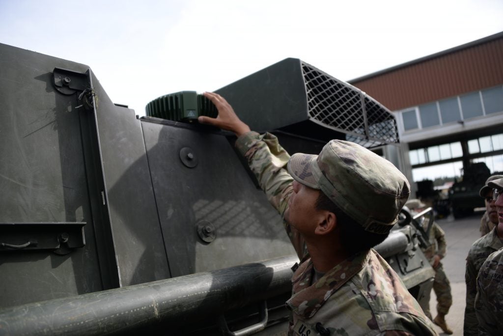
Jam resistant GPS fitted to Strykers in Germany
The US Army’s 2nd Cavalry Regiment have fitted the first 62 examples of the Mounted Assured Precision Navigation & Timing System (MAPS) anti-jam devices to their M1126 Stryker infantry carrier vehicles (ICVs). The MAPS roll-out will eventually see some 300 Strykers upgraded with the device.
According to a US Army spokesperson, MAPS “uses a chip-scale atomic clock for timing, Selective Availability and Anti Spoof Module [SAASM] for GPS, and anti-jamming antenna to distribute PNT [positioning, navigation, and timing] information.” MAPS is under constant refinement via an Other Transaction Authority, working with a number of technology vendors.
The upgraded Strykers feature a GPS receiver with a MAPS anti-jamming antenna designed to allow the GPS to operate when under electronic attack. MAPS will later be integrated with the M1A1 and A2 main battle tank, the M2 and M3 family of Bradley infantry fighting vehicles and the M109A7 Paladin self-propelled howitzer. A dismounted version of MAPS, the Dismounted Assured Positioning, Navigation and Timing (DAPS), is also under development as one element of the US Army’s Nett Warrior programme.
During the Trident Juncture NATO exercise in Norway last year, Russian electronic warfare measures were detected targeting NATO GPS signals and tracked to a Russian military facility on the Kola Peninsula. US unmanned aerial systems (UAS) have also been the target of Russian jamming attempts in Syria.

Russian jamming falls into two categories; the active jamming of GPS signals reaching GPS receivers and so-called GPS spoofing which uses a false signal to confuse GPS receivers of their true location. Russian efforts in Syria have included both signal denial and spoofing and has been reported as originating from the Syrian regime Khmeimim Air Base. Their counter-GPS efforts came to prominence after the January 2018 unmanned aerial vehicle (UAV) swarm attack against the air base in Latakia using commercial UAVs.
The US and NATO partners are looking at Precision Inertial Navigation Systems (PINS) which require no active GPS signal to function. According to the US Defense Advanced Research Projects Agency (DARPA), PINS operates using “… cold atom interferometry for high-precision navigation without dependence on external fixes for long periods of time.”
Even this technology however does eventually require a position fix and DARPA are investigating the development of “… sensors that use signals of opportunity, which are non-navigation signals from sources like television, radio and cell towers, and satellites, as well as natural phenomena, such as lightning.”

