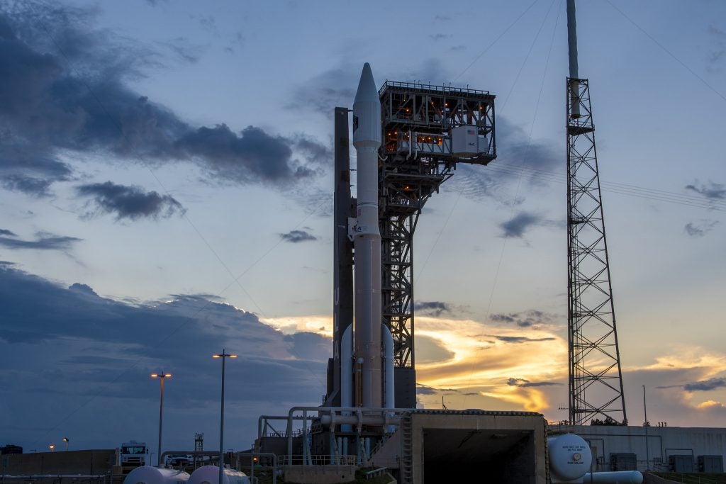
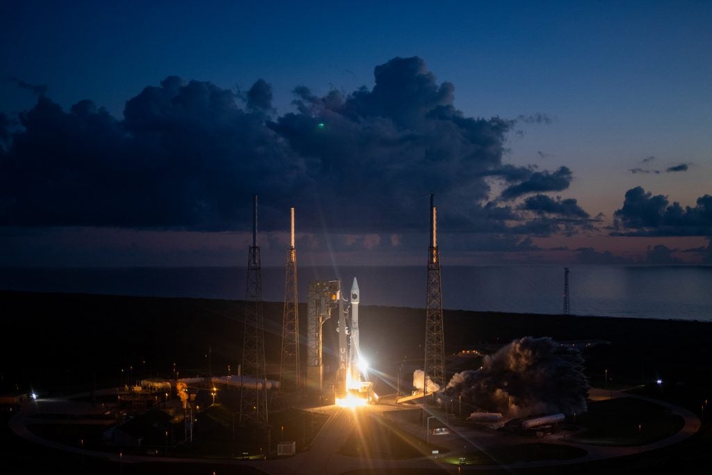
Space Based Infrared System Launch Marks the End of an Era
Early on the morning of 4 August, an Atlas V launched from Cape Canaveral Space Force Station carrying the sixth and final satellite of the Space Based Infrared System (SBIRS-GEO). This is a constellation of high-resolution imaging infrared satellites that hover over the earth on geostationary orbits (GEO) which allows them to remain in a fixed position relative to the earth’s rotation. Frozen in the sky they act as an unblinking eye able to detect ballistic missile launches within seconds giving early warning to either a nuclear or conventional attack.

SBIRS’s predecessor, the Defense Support Program, became operational in the mid-1970s and has remained active ever since. Originally the use of missile detection satellites was purely to provide an early warning of a nuclear attack in order to guarantee enough time for nuclear retaliation and thus maintain a state of deterrence. While DSP performed the nuclear mission perfectly the end of the cold war brought new problems.
In 1991, Israel and Saudi Arabia came under bombardment by Iraqi short-range ballistic missiles resulting in many casualties. DSP’s inability to precisely locate launch sites and more importantly where the missiles would land became a key limitation. Thanks to advances in infrared imaging sensors, SBIRS would be able to detect and track the entire spectrum of ballistic missiles.

The first satellite reached orbit in 2011 with 3 more following before the system’s first combat test in 2020. In retaliation for the assassination of Qassem Soleimani, Iran launched an unprecedented 16 missile barrage against US forces in Iraq. SBIRS detected the missiles, predicted their targets, and allowed US forces to evacuate before the missiles arrived. Due to base security concerns, some soldiers remained and suffered minor injuries from concussions. While not explicitly mentioned, SBIRS data is likely being passed to Ukraine for missile warning.
Enter Hypersonics
Just as SBIRS had been designed for an evolving threat its successor, the Overhead Persistent Infrared program (OPIR), would also represent a new threat. In 2014 China test flew a hypersonic glider and suddenly everything changed. While ballistic missiles fly in predictable lofted trajectories, gliders by nature can’t be predicted so they must be persistently tracked. While GEO orbits are great for constant observation of a specific area their altitude of 36,000 km limits the resolution of even the most capable sensors. Even if it could track from that altitude the latency wouldn’t allow it to be used for fire control data. Thus SBIRS would be hopeless against this new threat. During the Reagan administration low earth orbit missile tracking constellations were dreamt up but the technology at the time wasn’t ready. Luckily, SpaceX had arrived.
In 2015, it was announced that Starlink would revolutionize satellite communication by bringing it from GEO down to LEO (36,000 km down to 550 km). Using inter-satellite lasers, latency was dramatically improved in one case going from 1200ms to just 50ms. The one catch was since each satellite had a more limited view of the earth thousands would be required for the same coverage. Luckily SpaceX had developed the revolutionary Falcon 9 which allowed megaconstellations to be put into orbit without obscene launch costs. Could such technology be adapted to missile tracking?

An entire government entity, the Space Development Agency (SDA), was established for that very purpose. The SDA will build a Tracking Layer as part of its missile warning and tracking megaconstellation. Operating in LEO much like Starlink, these cheaper and more numerous imaging infrared satellites will be able to track hypersonic gliders as they maneuver through the atmosphere. Using a Transport Layer with inter-sat lasers as a datalink the system will even be able to provide fire control data to interceptors such as the Glide Phase Interceptor. Details about the recent awards for the first operational Tracking Layer satellites have been covered here.
End of an Era
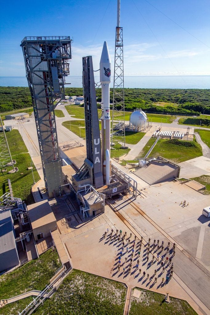
The final launch of the SBIRS-GEO constellation also closed another chapter being the last launch from the Cape of the original 4-meter Atlas payload fairing nose cone, first flown 1991. This fairing is very symbolic as it has been in use since the Atlas II which came into being following the Challenger disaster of 1986. Following that horror, the DoD recognized that the Space Shuttle couldn’t replace expendable vehicles. Shortly thereafter, the USSR collapsed and competition gave way to cooperation. Atlas V would adopt the superb Russian RD-180 engine and would serve as the backbone of US access to space from 2002 until the arrival of the Falcon 9. With Russia’s decision to approach fascism, the Atlas V is itself a symbol of a friendly era that is now long past. The vehicle will be retired once the US inventory of 21 Russian-built RD-180s runs out in 2028 or 2029 though these will all be in 5-meter or Starliner configuration.
